


Voting District 30, Tulsa County, Oklahoma
About
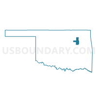
Outline

Summary
| Unique Area Identifier | 655463 |
| Name | Voting District 30 |
| County | Tulsa County |
| State | Oklahoma |
| Area (square miles) | 1.37 |
| Land Area (square miles) | 1.37 |
| Water Area (square miles) | 0.00 |
| % of Land Area | 100.00 |
| % of Water Area | 0.00 |
| Latitude of the Internal Point | 36.15229210 |
| Longtitude of the Internal Point | -95.99051670 |
Maps


Graphs
Select a template below for downloading or customizing gragh for Voting District 30, Tulsa County, Oklahoma


Neighbors
Neighoring Voting District (by Name) Neighboring Voting District on the Map
- Voting District 122, Tulsa County, OK
- Voting District 14, Tulsa County, OK
- Voting District 147, Tulsa County, OK
- Voting District 15, Tulsa County, OK
- Voting District 46, Tulsa County, OK
- Voting District 47, Tulsa County, OK
- Voting District 49, Tulsa County, OK
Top 10 Neighboring County Subdivision (by Population) Neighboring County Subdivision on the Map
Top 10 Neighboring Place (by Population) Neighboring Place on the Map
Top 10 Neighboring Unified School District (by Population) Neighboring Unified School District on the Map
Top 10 Neighboring State Legislative District Lower Chamber (by Population) Neighboring State Legislative District Lower Chamber on the Map
Top 10 Neighboring State Legislative District Upper Chamber (by Population) Neighboring State Legislative District Upper Chamber on the Map
Top 10 Neighboring 111th Congressional District (by Population) Neighboring 111th Congressional District on the Map
Top 10 Neighboring Census Tract (by Population) Neighboring Census Tract on the Map
- Census Tract 25, Tulsa County, OK (3,980)
- Census Tract 27, Tulsa County, OK (3,291)
- Census Tract 23.01, Tulsa County, OK (2,835)
- Census Tract 31, Tulsa County, OK (2,620)
- Census Tract 12, Tulsa County, OK (1,824)
- Census Tract 32, Tulsa County, OK (1,511)
- Census Tract 10, Tulsa County, OK (1,421)
- Census Tract 9, Tulsa County, OK (1,384)